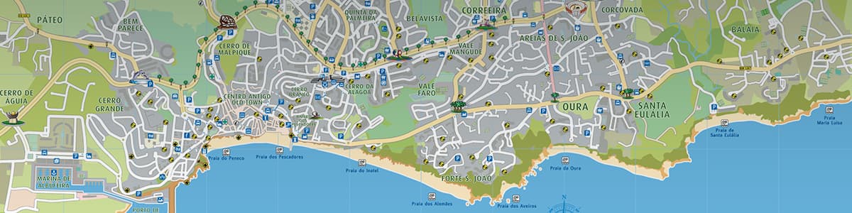
Interactive Maps of Albufeira Learn your way around town and across the region
Albufeira is located on the south coast centre of the Algarve region which itself is the southernmost region of mainland Portugal and Europe's westernmost tip. The Algarve has an area of nearly 5000Km² and an average population density of 80 inhabitants per km².
Its 150km length coastline faces the Atlantic mostly to the South and partly to the West on the “Costa Vicentina”. Its territory is divided into 3 main areas, “Litoral (coastal)” – where most of the tourist activity is concentrated; “Barrocal (the inland)” – territory mainly dedicated to agriculture and “Serra (the hills)” – mountainous part which occupy around half of the region
This area of the website is still being developed.
We plan on having the information gradually ready within a couple of weeks.
Please, come back and visit soon.